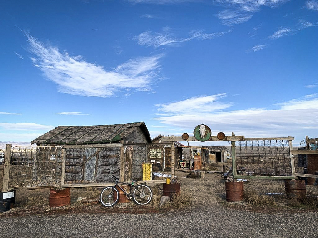
Orignally, Cisco was founded in the 1880's as a watering
stop for the Denver and Rio Grande Western
Railroad.
By the 1920's, oil was discovered, and
for a time Cisco became the largest oil producer in
the state.
However, Cisco's prosperity was short-lived.
Cisco quickly became a ghost town as diesel engines replaced steam-powered
trains and the construction of Interstate 70 rerouted the flow of traffic.
Currently, Cisco is known for being the backdrop of many movies.
Including, Vanishing Point (1971),
Thelma and Louise (1991), and
Don't Come Knocking (2005), to name a few.
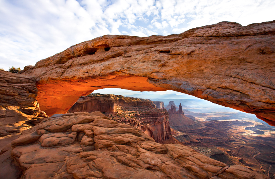
Arches National Park
Arches National Park is a popular destination
for astronomers. The dark skies make it
possible to view the stars without light
pollution.
Delicate Arch is the most famous arch in the
park. It is a symbol of Utah and can be found
on many license plates throughout the state.
The ancient sand dunes in Arches National Park
are leftover from ancient lakes in the area and are
now called Petrified Dunes.
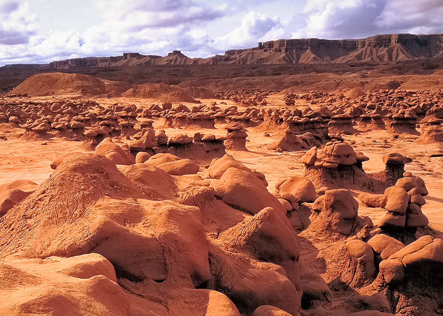
Goblin Valley State Park
It was officially designated a state park on
August 24, 1964.
The park features thousands of formations of
mushroom-shaped rock pinnacles called hoodoos.
Goblin Valley is known for several rock art
panels, as well as the many rock formations.
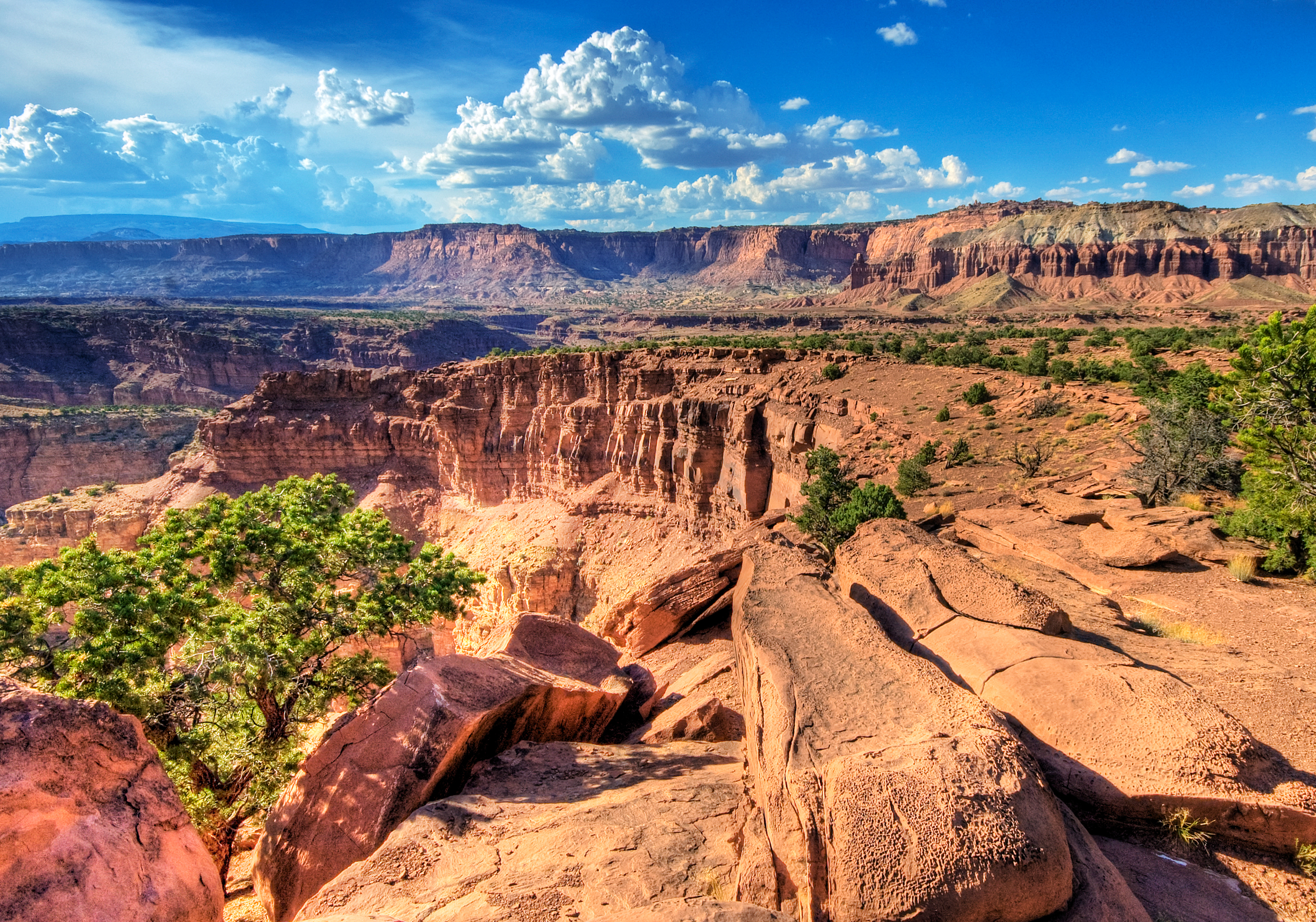
Capitol Reef National Park
The white dome formations are what gave the
park its name. The domes were thought to have
looked like the United States Capitol Building.
There are orchards located within the park
where park visitors can enjoy picking fruit.
Every year, approximately 784,000 people visit Capitol
Reef National Park to see and experience its many wonders.
Natural Bridges National Monument
The three natural bridges in the park are
named Kachina, Owachomo, and
Sipapu. These
are all Hopi names, the language of the Hopi
Native Americans.
Sipapu is the
thirteenth largest natural bridge in the world.
Electricity in the park comes entirely from
a large solar array near the visitors center.
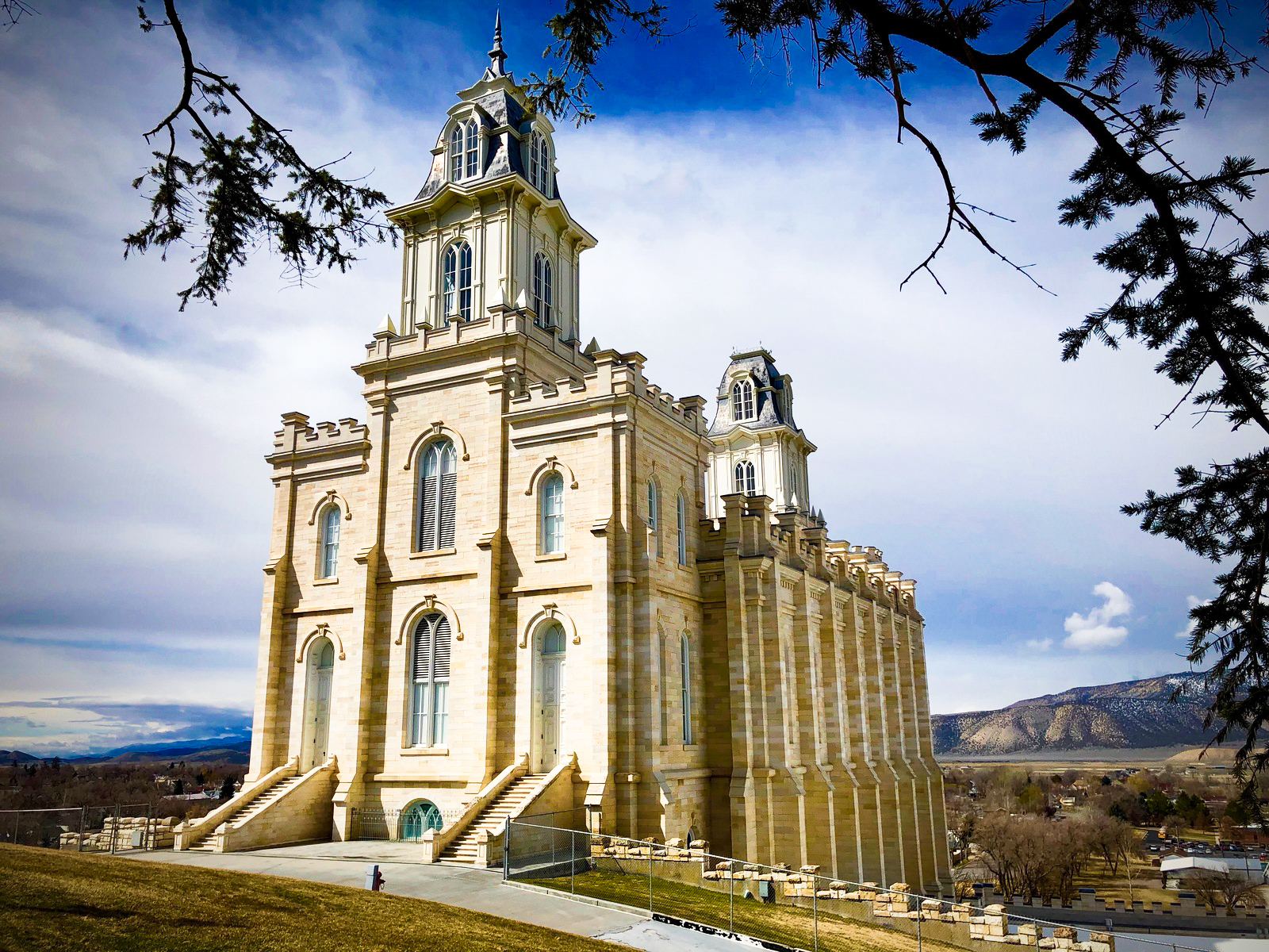
Manti LDS Temple
The Manti Utah Temple was the third temple
built in Utah.
The temple was built on a rattlesnake-infested
site, known as the Manti Stone Quarry.
A Norwegian boat builder was in charge of
designing the ceiling in some parts of the
temple. He was not sure how to go about it, so
he used the design of a boat and turned it
upside down.
Interesting fact:
In the United States, there are three large-scale stairways
constructed with no central support, and two of those are located
in the Manti temple. Each makes six complete circles and
has 151 steps.
Grand Staircase - Escalante National Monument
Grand Staircase-Escalante National Monument spans
approximately one million acres of America's public
lands and contains three distinct units-
Grand Staircase, Kiaparowits, and Escalante Canyon.
The oldest evidence of human habitation on the
Colorado Plateau can be found at Grand Staircase-
Escalante National Monument. The monument also
contains the world's richest fossil trove of the Late
Cretaceous period.
The Ute, Hopi, Zuni, Navajo, and Paiute nations
all have cultural affiliation with the lands
protected within the monument.
Moab
Moab is near both Arches National Park and
Canyonlands National Park, and is a destination
for many mountain bikers and offroad enthusiasts.
Slickrock Bike Trail is one of the most
technically challenging bike trails in the
world.
Visitors to the area are also likely to go
river rafting down the Colorado River or
Green River.
Interesting fact: A gang of outlaws called the Wild Bunch, led by
Butch Cassidy, was active near Moab. Their Robbers
Roost hideout was in the canyons east of town.
Aneth, Utah
Aneth is a Census Designated Place (CDP). This
means it is not a city and has no city
government, but is a concentrated group of
people counted on a census for convenience.
Aneth had a population of 504 as of July 1, 2018.
People believe that the name Aneth came from
the Bible, meaning "fields".
Navajo Twin Rocks
On the north side of Bluff, Utah stand the rock
pillars known as the Navajo Twins.
This landmark is named for the Hero Twins of
Navajo Legend.
The formations were sculpted by wind and water
for many millennia.
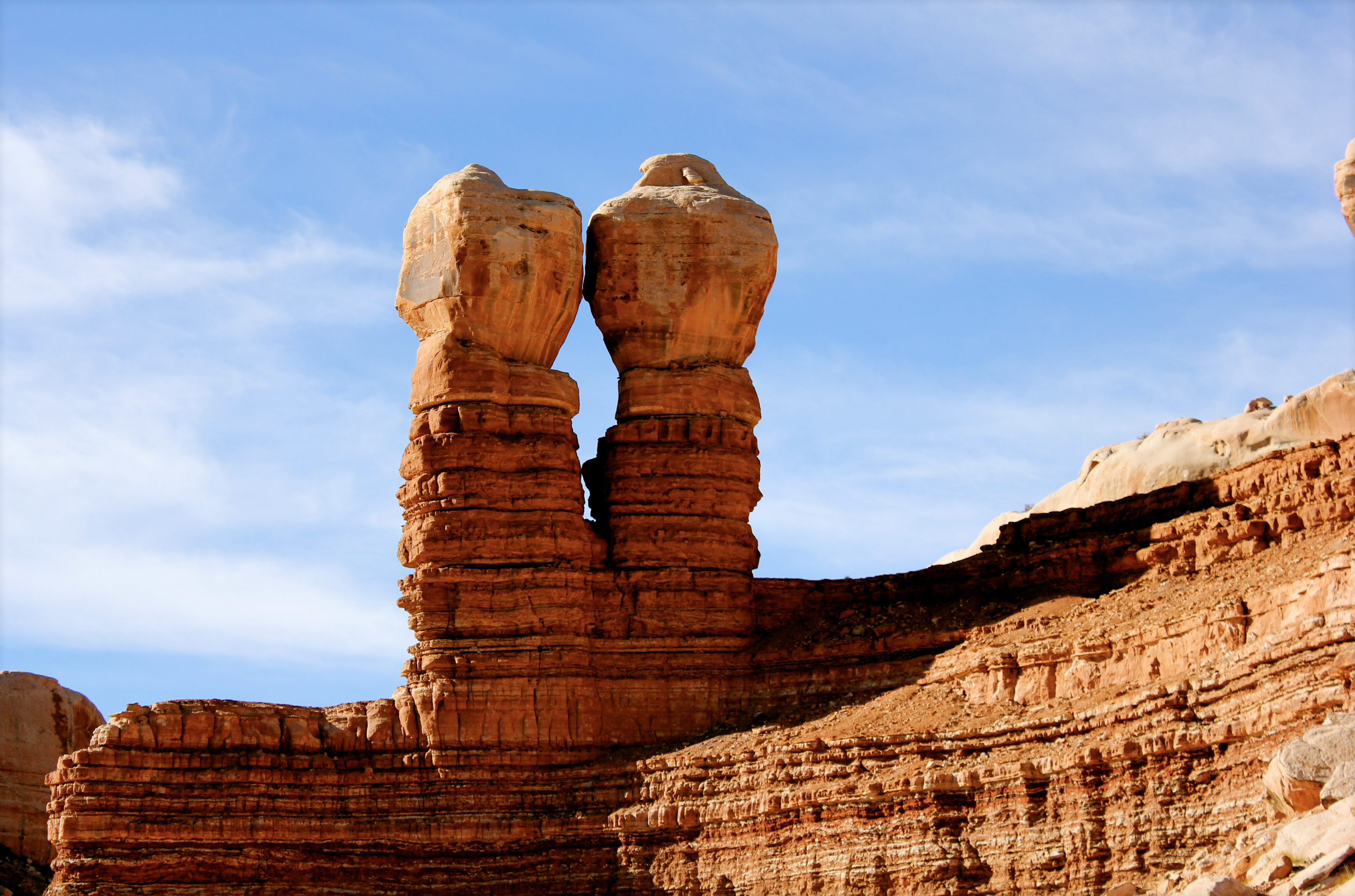
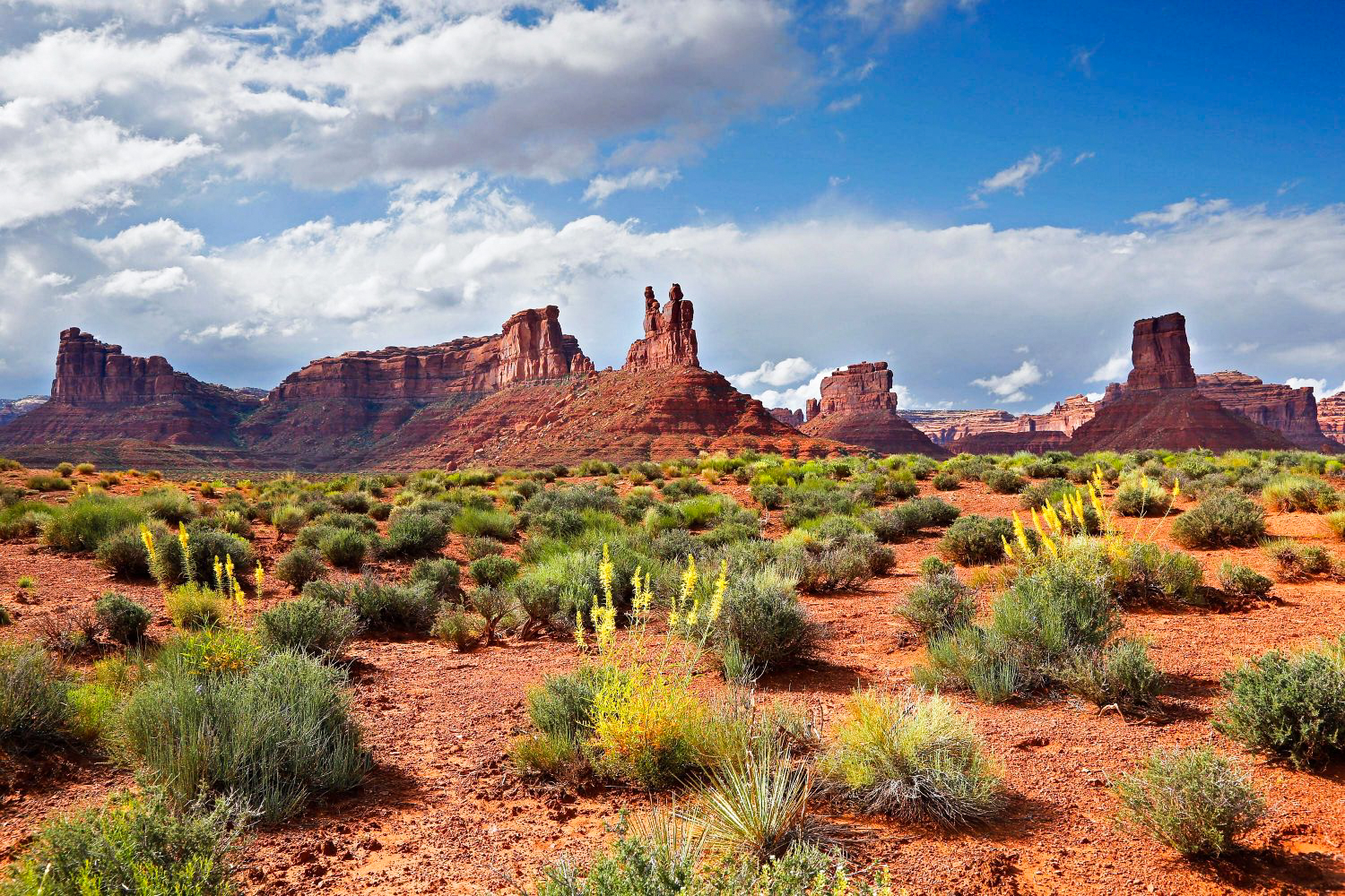
Valley of the Gods
Valley of the Gods is a beautiful scenic
backcountry in Southeastern Utah. There are no
designated trails or campgrounds, but there is
plenty of backcountry to explore.
Visitors can drive a 17-mile gravel road that winds
through the valley's many unique formations.
Valley of the Gods has been the backdrop for
many western movies, commercials, and television
shows including two episodes of Doctor Who: "The
Impossible Astronaut" and "Day of the Moon".
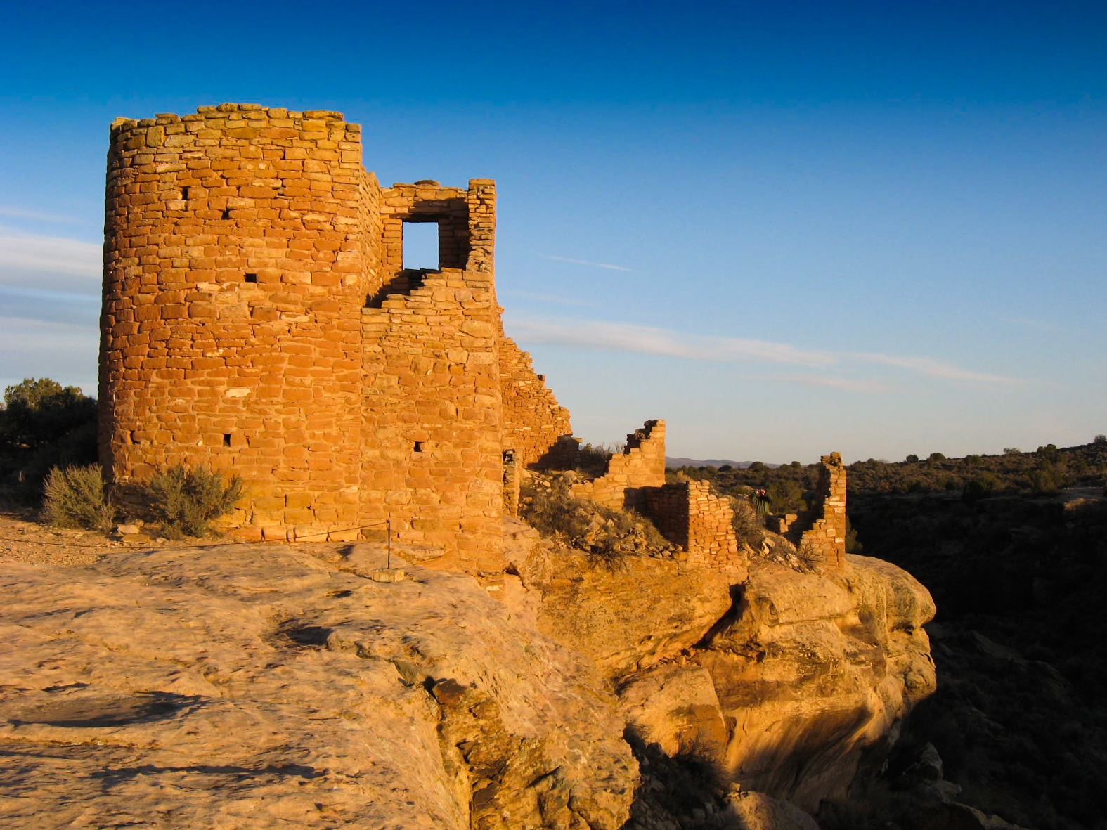
Hovenweep National Monument
In 1854, William D. Huntington discovered the
ruins of Hovenweep while on a missionary trip
to the southwestern United States.
Hovenweep includes six different prehistoric
villages built between 1,200-1,300 A.D.
There is evidence of
hunter-gatherers
living in the area as far back as 8,000 B.C.
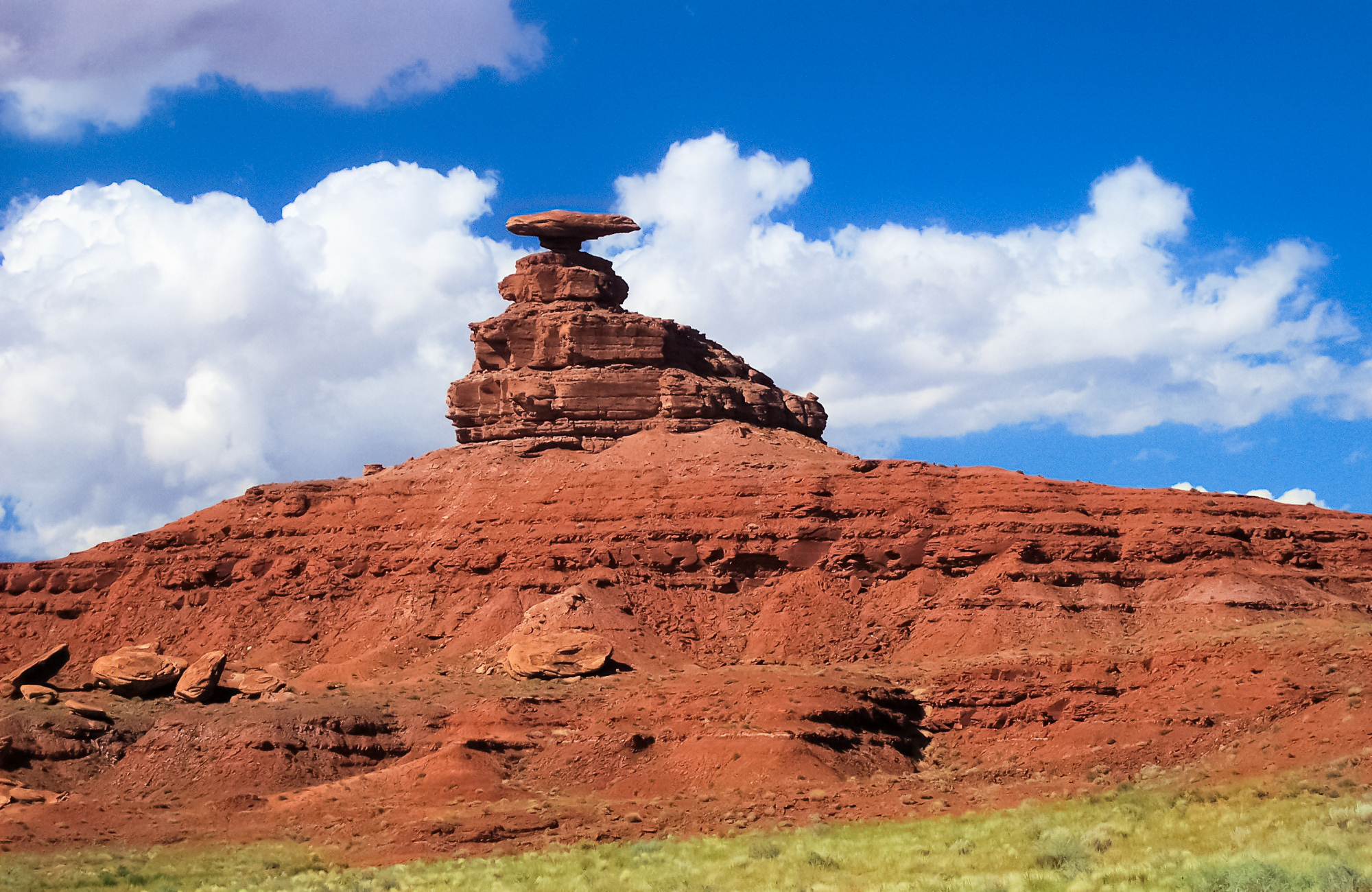
Mexican Hat
This rock formation gets its name because it
looks just like a man wearing a sombrero.
Mexican Hat is a 60 feet (18 m) wide rock which
lies upon a much smaller rock which gives it
the look of a Mexican Sombrero made of stone.
You can see the formation from Highway 163.
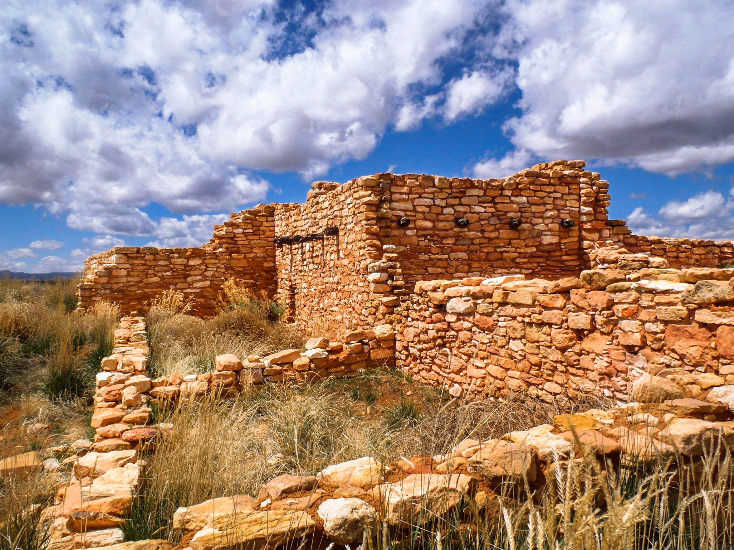
Ponch House Ruins
W. H. Jackson, a geological survey photographer
and explorer, discovered these ruins in 1875.
Many of the ruins are only accessible by boat
on the nearby river.
Rainbow Bridge National Monument
Rainbow Bridge is the largest natural bridge
in the world at 290 feet (88 m) tall and 270
feet (83 m) across.
The Douglas-Cummings surveyor party officially
discovered the bridge in 1909.
Visitors can take a boat to see the bridge,
or can access it by a 14-mile trail.
Church Rock
While the naming of Church Rock is shrouded in myth,
many believe it was named by a cult group from the 1930s.
The small opening on the front of the rock was
created in the 1940s with the use of dynamite.
The opening was used to store salt licks and feed
for the proporty owners' cattle.
Church Rock can be seen along the eastern side of U.S.
Route 191, near the entrance to the Needles District of
Canyonlands National Park.
Emery County
Emery County was named after the territorial
governor, George W. Emery.
Coal mining has been a main source of economic
growth and industry in the county.
Emery County is home to a wide variety of land features
which include national parks and monuments.
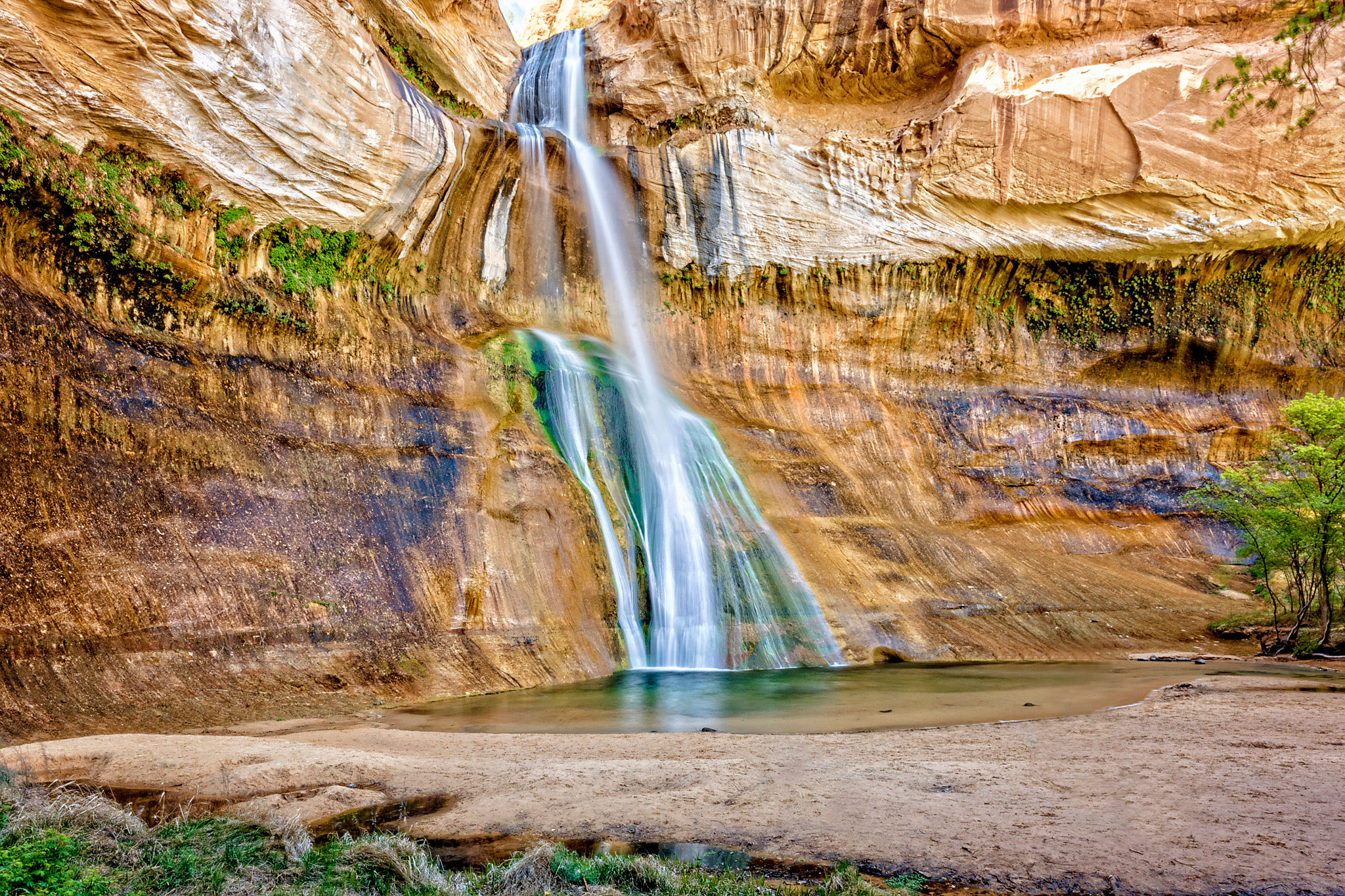
Calf Creek Falls
Calf Creek Falls is a continuously flowing
waterfall that is 214 feet (65 m) tall and is
located in Grand Staircase-Escalante National Monument.
Calf Creek is divided into two separate falls,
the upper and lower falls. Guests can hike to each
of the falls and enjoy their unique beauty.
The green and yellow algae lining the waterfall is
beautifully juxtaposed against the red sandstone,
and thrive due to the falls' year-round flow.
Green River Water Rafting
Average descents down the river are 13 feet per
mile (2.5 m/km). The river tumbles past soaring
red rock walls.
Native American ruins and rock art can be seen
along the river and in its surrounding areas.
Wedge Overlook/Buckhorn Draw
The Wedge Overlook is sometimes called "Utah's
Little Grand Canyon". The view from the wedge is
considered by many to be one of the best in Utah.
Over 1,000 feet below the overlook, the San
Rafael River runs through the canyon, and creates
a spectacular place to hike, camp, and explore.
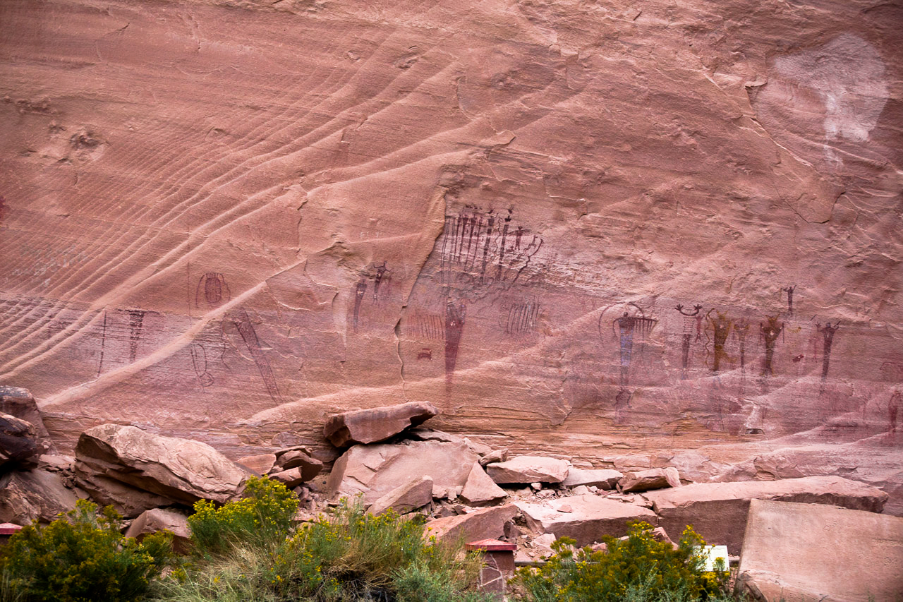
Buckhorn Draw Road is the main route into the canyon and
enables access to the Buckhorn Draw Pictographic Panel.
The panel is a 150 foot wide and includes dozens of well-preserved pictographs
and petroglyphs.
Monument Valley
The valley floor's elevation ranges from
5,000-6,000 feet (1,500-1,800 m) above sea
level, and the tallest rock formation stands
1,000 feet above the valley floor.
The ancient Anasazi people inhabited the
valley until AD 1300. The valley is filled
with ruins and rock paintings left by its
earliest inhabitants.
The valley has been the backdrop for many
films and advertisements. Some of the most
well-known films are Stagecoach, My Darling Clementine,
She Wore a Yellow Ribbon, The Searchers, How the West Was Won,
Easy Rider, 2001: A Space Odyssey, Indiana Jones and the Last Crusade,
Back to the Future 3, Mission Impossible 2, The Lone Ranger (2013),
Forrest Gump, and Jurassic World: Fallen Kingdom, to name a few.
In the words of Keith Philips,
"its (Monument Valley's) five square miles have
defined what decades of moviegoers think of when
they imagine the American West."
Moss Back Butte
The dictionary definition of a butte is an isolated hill with steep sides
and a flat top. Moss Back Butte, located near Natural Bridges Monument, is a
classic example.
The formation is a composite of erosion-resistant sandstone
and stands at an elevation of 7,736 feet (2358 m). If you
drive northeast on Utah State Route 276, you can see
it standing alone on the left side of the highway.
The Butte is part of a larger geological formation called
the Chinle Formation, which extends to parts of Arizona, Colorado, Nevada, and Utah.
Edge of the Cedars State Park Museum
The area was named by the cowboys who
camped in the area during the late 1800s.
They called it "Edge of the Cedars" because of a
natural transition from a heavily
forested region to a treeless landscape.
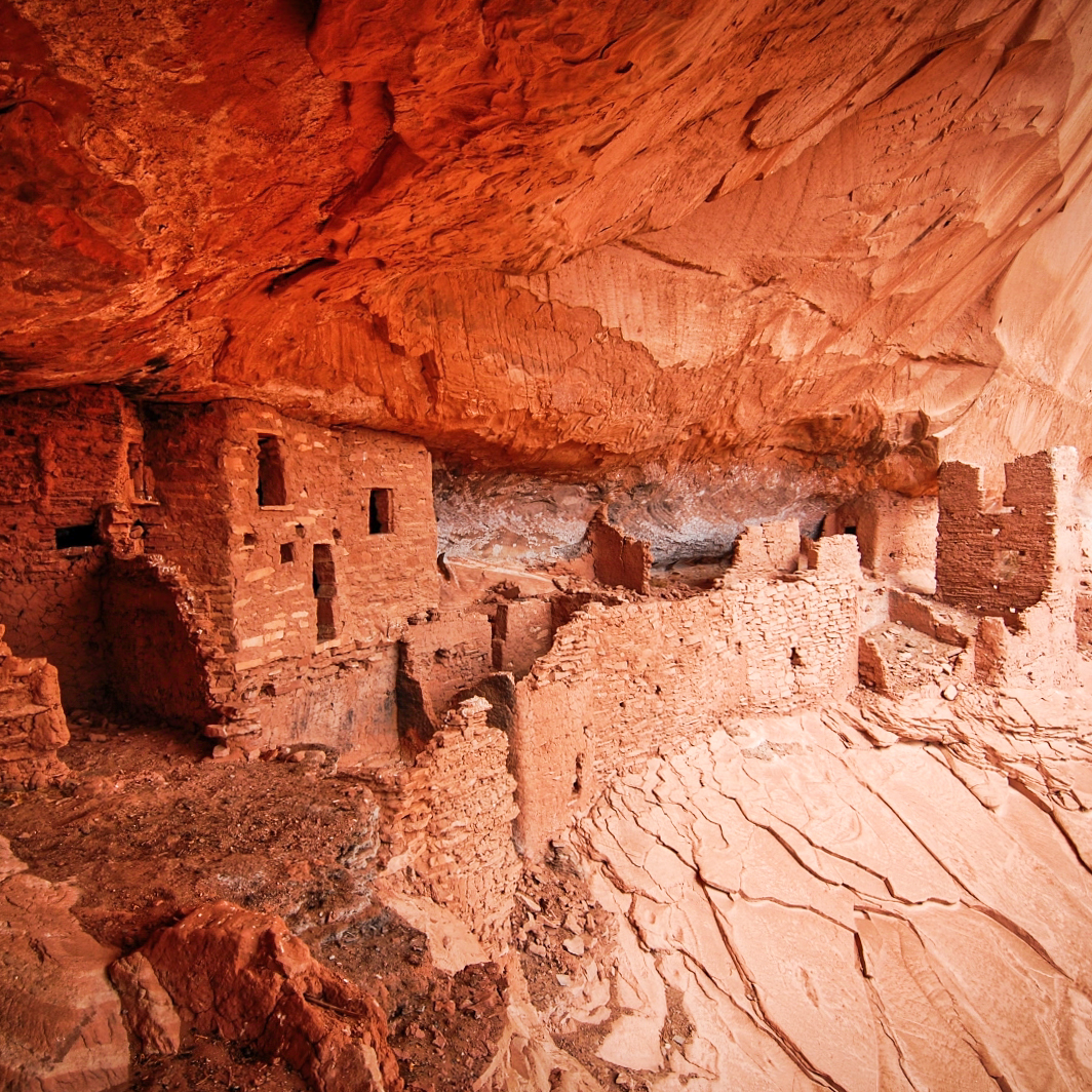
Edge of the Cedars State Park, located in the Four Corners
region of Utah, is a preservation site for ancient Anasazi
dwelling places.
Edge of the Cedars has the largest collection of Ancestral
Puebloan (Anasazi) pottery on display in the Four Corners
Region and offers special exhibits, festivals, and
events throughout the year.
Canyonlands National Park
On September 12, 1964, President Lyndon B.
Johnson signed Public Law 88-590 establishing
Canyonlands as a national park.
Canyonlands National Park is open year-round and
welcomes about 400,000 visitors per year. The park
is a favorite destination for hikers, mountain bikers,
backpackers, and four-wheel enthusiasts.
A wide variety of wildlife calls the park home. These
animals include black bears, coyotes, skunks, bats, elk,
foxes, bobcats, badgers, ring-tailed cats, pronghorn,
cougars, and at least 273 species of birds.